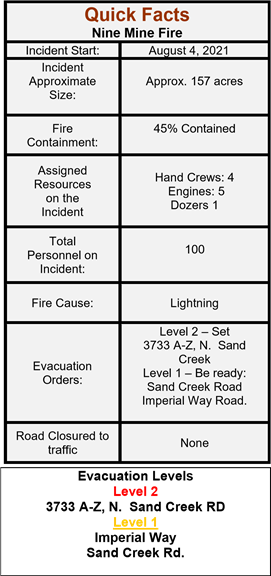
Orient, WA – The Nine Mine Fire is located 4.5 miles south / southeast from Laurier, WA. This lightning caused fire started on Wednesday, August 4th and has burned approximately 157 acres of forested land. Acreage growth is based on burnout operations.
Evacuations: This morning Level 2 evacuation, for ONLY 3733 A-Z, N. Sand Creek Rd ONLY. This is due to weather, fire behavior and burnout operations.
The remaining Sand Creek addresses and Imperial Way will remain under level 1 evacuation.
Road Closures: Nine Mine Rd. has been reopened to traffic. Use caution if driving this road and watch for fire traffic.
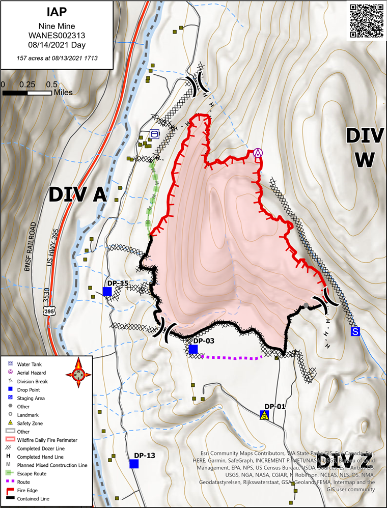
Yesterday, firefighters successfully initiating planned burnout operations along the NW section of division Alpha. Containment lines from division Whiskey to division Alpha were completed and reinforced prior to burnout operations. Zulu division has been moped up 150’ and has been put into a patrol status.
Overnight an IR flight was completed. The aircraft is equipped with the ability to Infrared scan the entire burn area and map fire hot spots within containment lines. This helps fire managers place resources in the areas that need attention.
Today, Firefighter’s mission today will be mop up of the burnout area from yesterday’s operations. Division Z will be in a patrol status while mop up continues in division W.
Sunny skies and hot temperatures with low relative humidity today, along with gusty afternoon winds can change fire behavior and will be monitored throughout the day.
You can also follow up on Facebook at: https://www.facebook.com/newimt3/
https://www.facebook.com/newfireinfo/
And Inciweb at: https://inciweb.nwcg.gov/incident/7783/